Ensemble

for Smart Communities

Ensemble for Smart Communities2017-12-01T18:04:13+01:00

Efficient government and engaged communities

Ensemble for Smart Communities contains essential tools and applications developed to support business processes in national, regional and local governments. Our proven solution significantly improves or transforms daily tasks within public administration. Available as a cloud based solution delivered via the web, it is also helping to build smarter communities, and allow more engaged citizens.

real estate

Ensemble for Smart Communities

Ensemble for Smart Communities provides for a wide range of G2G (Government-to-Government) and G2C (Government-to-Citizen) processes.

Key Benefits:
  • Eases and simplifies the performing of daily operational tasks

  • Assists in the process of planning and decision making

  • Increases the speed and quality of services

  • Allows optimization and monitoring of costs

  • Offers flexibility and scalability from single to any number of users

  • Flexible implementation – from fully managed cloud-based solution to self-managed infrastructure and resources

  • Allows transparent 2-way communication between organisation and citizen / website visitor

  • Built on world leading Esri platform

Fully Supporting Essential Daily Tasks.

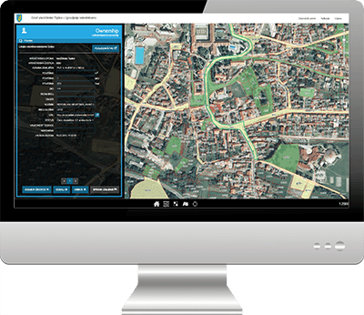
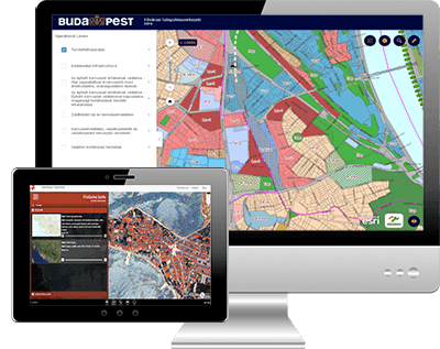
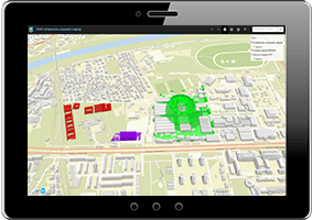
Selected tools and applications for local, regional and national government:

  • Visios
    Provides generic, functionalities such as: map visualization, data querying and data entry. Visios is easily expanded via a widget framework – widgets can be added to provide support for extra functionalities. These include those for general tasks or more importantly those that allow the ability of certain user roles to carry out their business process related tasks.

  • Greenery Management
    Complete management of all green spaces (parks, traffic islands, flower beds, lawns, trees), public facilities (benches, bins) and many others.

  • Public Lighting
    Enables management of unique sets of information about public infrastructure. Enables two way communication between local government (the owner of public infrastructure), the concessionaire (responsible for the maintenance of the infrastructure) and citizens.

  • Roads Management
    A complete solution for data entry, processing and maintaining information about roads and road facilities.

  • Spatial Plans Register
    Provides for the management of physical planning documents.

  • Urban Identification
    Spatial planning and management system providing full reporting on selected areas of coverage.

  • Allocation of Land report
    Generation of reports on the use of the land surface at the desired cadastral plot. Both informal (citizen) and formal reports.

  • Utility Cadastre
    Centralized register and total management of utilities including water supply pipelines, telecommunications, oil pipelines, power cabling, drainage and heating systems.

  • Real Estate Management
    A complete solution for data entry, processing and maintaining information about real estate.

  • Permits Management
    Provides an optimized system of permits management.

  • Revenue Management
    Solution for tracking and management of income from property owned by local government.

|Insights

City of Zagreb 3D

Project Zagreb 3D In partnership with the City of Zagreb (Office for Strategic Planning and Development), GDi implemented the project Zagreb 3D. The result is a 3D model of the city that now

AREC

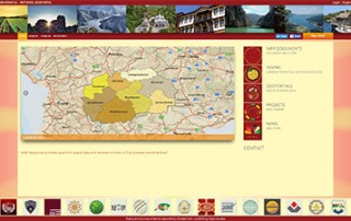
National GeoPortal of the Republic of Macedonia Created as part of the Real Estate Cadastre and Registration Project to manage the National Spatial Data Infrastructure (NSDI). "National GeoPortal of the Republic

Find out more

Transform your government organization and community

Share with others

Share Ensemble for Smart Communities information
Go to Top