Platform for the creation of web Geographic Information Systems (GIS) applications
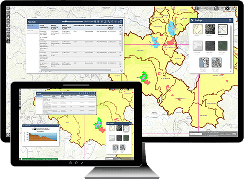
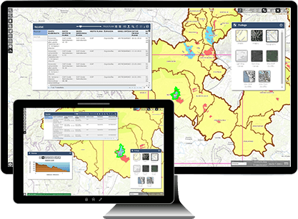
GDi Ensemble Business Suite Module for The Creation of Advanced Web GIS Applications allows users to easily create advanced GIS applications without any programming skills.
Utilizing a simple and intuitive user interface, a choice of pre-defined tools and functionalities, organized in the form of widgets, it is possible within a few minutes to create a unique web GIS application, including advanced functionality, such as data editing and geometric network analysis.
Once created, the application can be easily modified or overwritten. All configurable changes are visible in real-time within the application.
Our application is fully compliant with the Open Geospatial Consortium (OGC) standards.
Easily visualize your geographic data.
With Ensemble Business Suite Module for The Creation of Advanced Web GIS Applications, capture, store, analyze, manage and present your spatial data with ease.
Get meaningful insights using location intelligence to identify and derive solutions to problems.


Core components
Ensemble Business Suite Module for The Creation of Advanced Web GIS Applications core components.

Configurator
Web application for configuring web GIS viewer (Visios) applications.

User Management
Manage Smart Portal users, roles and privileges, and instances of web GIS applications.

Visios
Web GIS application for presenting, creating and managing geospatial content.

Field Tools
Manage and collect field data using mobile devices.

Configurator
Web application for configuring web GIS viewer (Visios) applications.

User Management
Manage Smart Portal users, roles and privileges, and instances of web GIS applications.

Visios
Web GIS application for presenting, creating and managing geospatial content.

Field Tools
Manage and collect field data using mobile devices.
Key Features
Create web GIS applications that seamlessly scale from just a few users, up to 1000s of users for large organizations and enterprises.
Greatly increase and improve company collaboration, information exchange and GIS content editing.
View and edit privilege on layer level.
Attributive filters on user level.
Spatial filters on user level.
Built using the Esri ArcGIS platform

Key Features
Visios applications work on all types of devices – desktop and laptop computers, tablet devices and smartphones.
Create web GIS applications that seamlessly scale from just a few users, up to 1000s of users for large organizations and enterprises.
Greatly increase and improve company collaboration, information exchange and GIS content editing.
View and edit privilege on layer level.
Attributive filters on user level.
Spatial filters on user level.
Built using the Esri ArcGIS platform

Configurator
Web component for the configuration of the Visios application.
Simple Interface
Choose pre-built tools and enter appropriate parameters. Tools are organized in the form of widgets. More than 30 widgets currently available.
Optimize Layout and Functions
Prior to live deployment to end users, easily test the layout and functionality of the Visios application.
Field Tools mobile Android App
During configuration of the Visios web GIS, a Mobile Android GIS application for field data collection is automatically created.
Built-In Security
The Configurator component can only be accessed from the User Management application, so that the Visios application can only be configured by an authorized user – i.e. the GDi Smart Portal administrator.
User Management
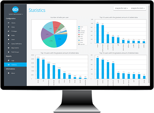
Web component for the administration of Smart Portal applications.
Easily administer and view:
- Clients – Number of possible Visios applications and their licence levels.
- Visios applications – basic information about Visios applications.
- Users – basic user information and user roles.
- Privileges – information on permitted data operations.
- Roles – the privilege group assigned to the individual Visios application.
- Data Filters – attributive and spatial data filters associated with individual users.
- Logs and usage statistics – determine all user activities (access to Visios application, logging out, adding and modifying data, deleting data …). Full reports generation.
User Management integrates with GDi Identity Provider, allowing Smart Portal to easily harmonize with, for example, users from the Microsoft Active Directory.

Visios
Access GIS data at any time and location user any internet browser.
Visios is a web application through which GIS data and content can be searched, changed, analyzed and presented. All browser functions are defined by simple configuration through the Configurator application. In addition to basic search and identification features of geographic (geo) objects, Visios includes advanced features such as:
| ✓ | Enter and edit geometry and geo object attributes. |
| ✓ | Spatial selection. |
| ✓ | Export of graphical and alphanumeric reports. |
| ✓ | Utilize external data services – MapService, Web Map Service (WMS), Web Map Tile Service (WMTS), etc. |
| ✓ | Statistical analysis. |
| ✓ | Linear referencing. |
| ✓ | Using predefined and user-defined basemaps (Esri, OpenStreetMap, Bing Maps, etc.). |
Field Tools
Manage and collect field data using mobile devices.
Ensemble Field Tools gives you the ability to record real-time spatial events and objects directly in the field. For every occurrence and object in the field, a real-time spatial location is considered, enabling timely and reliable decisions to be made.
| ✓ | Native Android application, iOS version available. |
| ✓ | Offline mode, Augmented Reality and iOS version available as separate modules. |
| ✓ | Fully supported relational model of spatial database. |
| ✓ | Fully comprehensive search facility. |
| ✓ | Identify, measure, split screen for map and attributes etc. |
| ✓ | Data editing, photo capturing, dynamic display of relationship data model in the tree structure. |
| ✓ | By configuring Smart Portal, Field Tools for Android app is automatically configured |
Deployment Options
We are eager to hear your specific needs and help you turn your geospatial data into high quality information.


Get Social