Ensemble

for Field Data Management

Ensemble for Field Data Management2016-07-14T16:34:54+02:00

Comprehensive data management for those on the move

Ensemble for Field Data Management is a simple and easy to learn application for inspectors, field engineers, supervisors, environmental researchers and other employees who need their organizational data in the field to be collected, reviewed and updated.

Ensemble for Field Data Management

Ensemble for Field Data Management

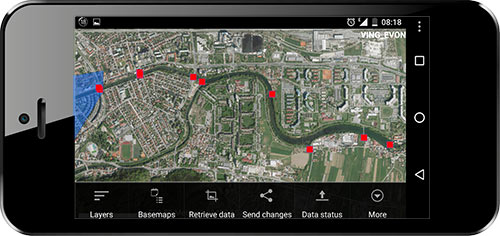
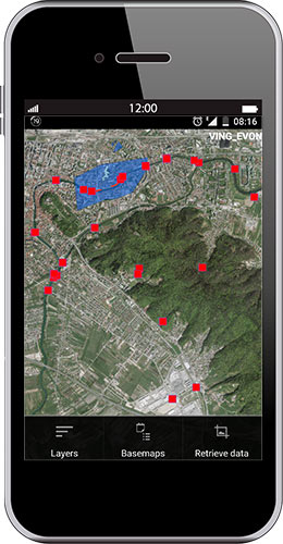
Comprehensive data collection and editing application for Android devices. It also offers the ability to capture and edit your data in offline mode –  anytime and anywhere you need it.

Key Benefits:
  • Timely and accurate data
    Location information is most accurate when updated in the field using mobile solutions. Delays and data errors are minimized when transferring data between the field and the office.

  • Low implementation costs
    Edit offline for lower mobile connection costs and use affordable Android devices on your existing ArcGIS Platform. Reorganize your fleet equipment based on what you really need, not what you have.

  • Greater productivity in the field
    No more spending extra hours due to slow or unreliable connections, edit your data offline and post it directly to your system when you can.

  • Make better business decisions
    Up-to-date and accurately collected data enables you to make better assessments of any situation. Reports are reliable and smarter decisions can be made.

  • Built for World leading robust ArcGIS platform.
    Designed for data exchange via ArcGIS Desktop, ArcGIS Server or ArcGIS Online and allows usage of your own data in any ArcGIS coordinate system.

All the Features you Need

Ensemble for Field Data Management features include:
  • Data collection, management and editing application.

  • Works on Android devices.

  • Works in online and offline mode.

  • Simple and intuitive user interface.

  • Fast data display (operational layers and basemaps).

  • Counter for changed features.

  • Feature search functionality.

  • Supports multiple basemaps simultaneously.

  • Support for all Esri registered coordinate systems.

  • Supports internal and external GPS sensors.

  • Snapping and Labeling.

  • Uses ArcGIS symbology.

  • Easy localization to any language.

  • Measuring of distance / area.

I need to know more

Transform your field data acquisition and management work process.

|Insights

NIS

Creating Business Benefits for Petroleum Industry of Serbia (NIS) One of the largest vertically integrated energy companies in South-East Europe with its principal activities related to exploration, production and refining, sales and distribution of a

Share with others

Share Ensemble for Field Data Management product information
Go to Top